The mercury remained around 2-6℃ at night in most parts of Punjab, Haryana as well as Delhi, which is in the grip of dense fog. (Symbolic photo: PTI)
North-west India is witnessing one of the driest winters in years, with no significant rainfall in the past few weeks. Fog conditions in the area have also worsened due to lack of rainfall.
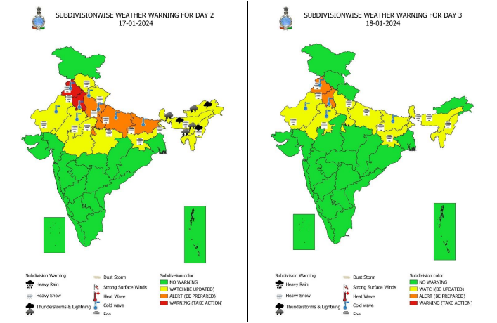
North-West India, which is being hit by dense fog, is going to get more cold in the next few days and there is a possibility of cold wave in this region. The India Meteorological Department (IMD) has issued an orange warning for northwest India, including the national capital, till January 20.
The weather department declares a cold wave when the minimum temperature drops below 4℃, and it becomes severe when it drops below 2℃. Such a spell may last for a few days but may last up to ten days during extreme winters.
The mercury remained around 2-6℃ at night in most parts of Punjab, Haryana as well as Delhi, which is in the grip of dense fog. Visibility has reduced to 25 meters in the morning, due to which flights are being disrupted. For the last four days, the night temperature in Delhi has remained around 3℃, due to which a cold wave is going on.
Ballowal in Punjab recorded the lowest minimum temperature in northwest India at -0.4 degrees Celsius on Monday. Unlike the winter of 2022, this time the region has been largely dry, with no significant rain or snowfall, raising concerns for the Himalayan states of Himachal Pradesh and Uttarakhand.
“There have been many instances in the past when there has been no rain in January. This is part of the year-to-year variability in weather. But this may prove to be a difficult situation for states, as winter rains are also important for replenishment of reservoirs,” said Dr Anand Sharma, senior meteorologist, IMD, in the east.
However, another weak western disturbance has affected North India, and it may cause light rain or snow at isolated places over Jammu and Kashmir, Himachal Pradesh and Uttarakhand on Wednesday. Jet stream winds of around 140-150 knots are blowing over the plains of North India, and ground level frost is also likely in Uttarakhand.
According to IMD, light to moderate rain may also occur in Bihar, Jharkhand, Chhattisgarh, Odisha, West Bengal, Sikkim and other parts of Northeast India in the next few days. The area remains covered with dense fog during morning and late evening hours and the situation is likely to remain like this for at least the next two to three days.
After slightly above normal temperatures for most of December, day temperatures now remain at least 4-6℃ below normal over most parts of northwest India. They remain within the 11-15℃ range during the day in Punjab, Haryana as well as Delhi.
Follow us on Google news ,Twitter , and Join Whatsapp Group of thelocalreport.in